New images have been released to explain road closures set to start today for works on a major York project.
As we reported earlier this month, overnight closures are planned around York Station from Monday evening to Friday morning during the first four weeks of June as part of the ongoing Station Gateway scheme.
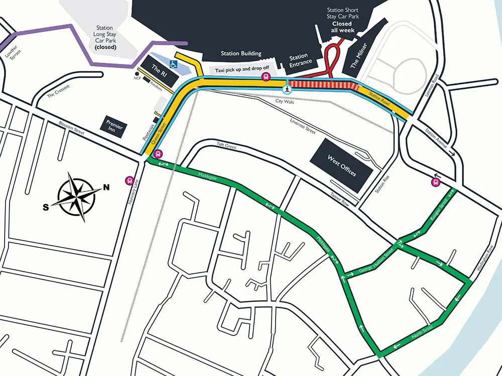
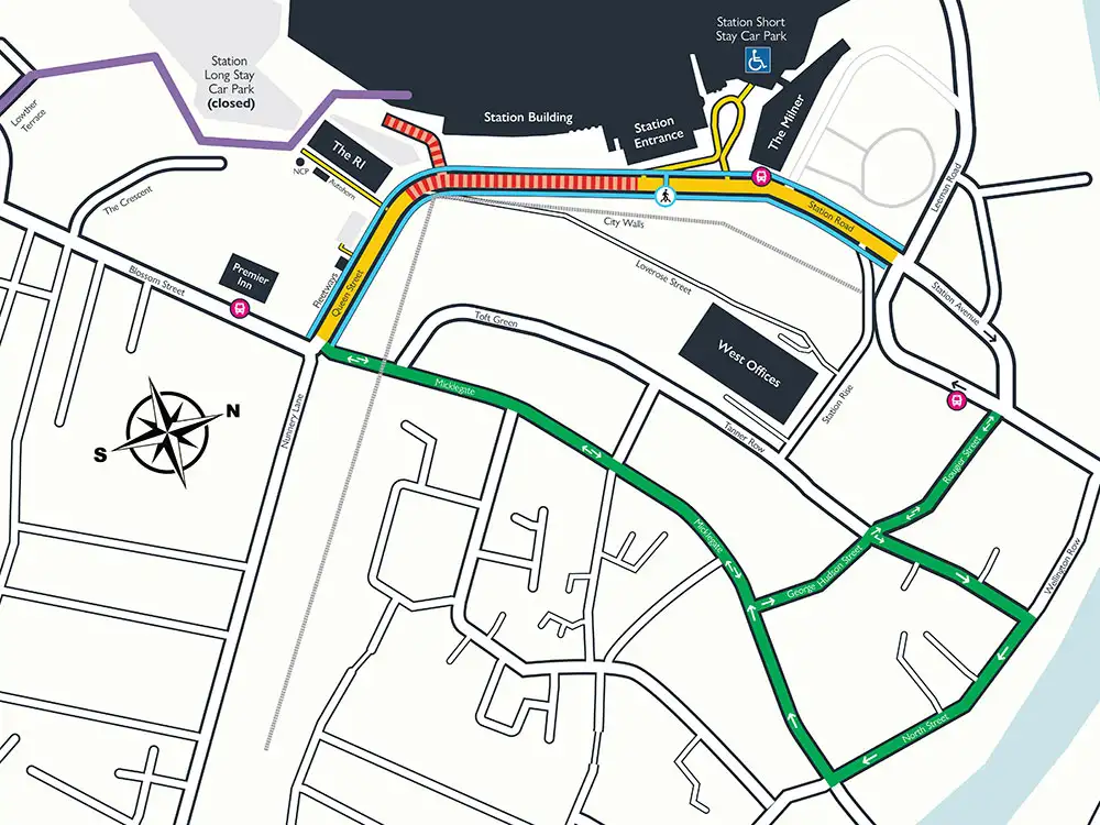
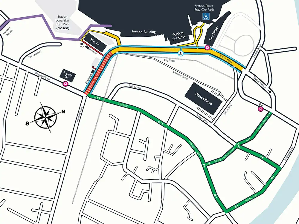
New City of York Council maps show which sections of roads are set to be closed overnight.
Road users and people travelling to, from and in and around York Station have been urged to plan ahead before their journeys.
A new cycle diversion is set to be in place due to Toft Green remaining closed.
Cllr Kate Ravilious, council’s Labour transport spokesperson, said people should take public transport, walk or cycle where possible to help reduce congestion in the area during the works.
Closures in Queen Street are set to be in place from 8pm to 6am, Monday to Thursday, for four weeks from today – Monday, June 1 – while works take place.
Map of closures
A key to the maps:
- Red: closed to vehicles and cyclists.
- Blue: pedestrian route.
- Purple: southern cyclist diversion route, station access via Platform One.
- Green: Micklegate to Station Rise cyclist diversion.
- Pink bus symbol: shuttle bus stop.
- Blue crossing symbol: pedestrian.
- Blue Badge symbol: Blue Badge parking spaces (parking to return to short stay after first week).
Week 1
Week 2
Week 3
There’s more about the Station Gateway scheme on the City of York Council website.